Map
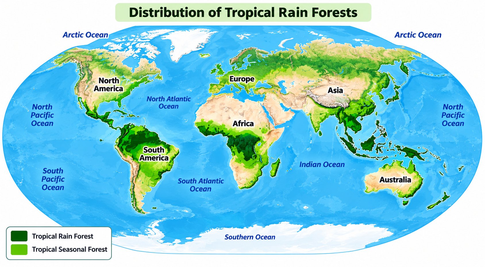
Distribution of Tropical Rain Forests
Prep: 25s
Record: 40s
Look at the image below. In 25 seconds, please speak into the microphone and describe in detail what the image is showing. You will have 40 seconds to give your response.
Sample Answer & Key Features
Review official key features and a band-9 reference response
Key Points to Include in Your Description:
- 1Illustrates distribution of tropical rainforests (dark green) and seasonal forests (light green).
- 2Main rainforest concentrations appear in northern South America, central Africa, and Southeast Asia including the Indonesian islands.
- 3Seasonal forests extend around several of these regions, creating broader zones of green.
- 4Northern Africa and central Australia show little to no forest coverage in contrast.
- 5Overall, most prominent rainforest regions form a belt around the equator spanning three major continents.